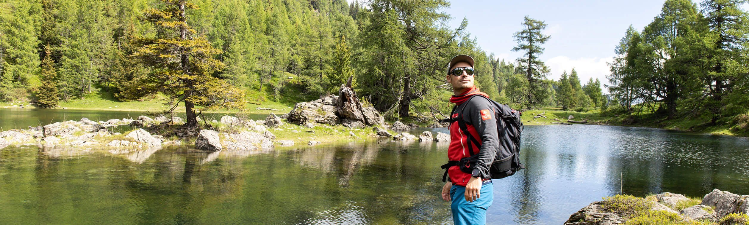
Guest blog: On old paths – hiking route around the two Wöllaner Nock peaks.
If you hear the mountain calling, snowboarding pro Alex Payer has the perfect route for you to try out near the Kaiserburgbahn. In his guest blog article, he sets off to explore the area around the two Wöllaner Nock peaks for you. Hike along its trails and find out here what awaits you on the tour.
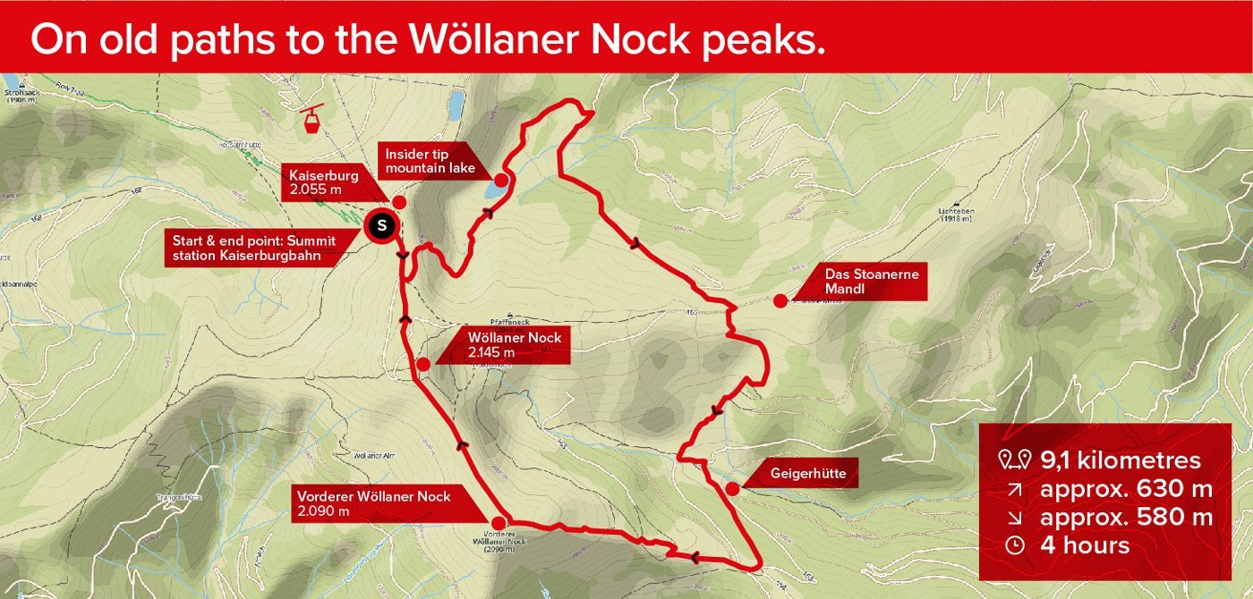
CIRCULAR ROUTE AROUND THE TWO WÖLLANER NOCK PEAKS.
– A hike along old paths with the highlight of the mountain lake and refreshment stop.
9.1 kilometres | approx. 630m altitude uphill | approx. 580m altitude downhill | approx. 4 hours
Start & end point: Kaiserburgbahn summit station
Route: Kaiserburgbahn summit station – Kaiserburg summit cross – continue towards Wöllaner Nock – on the way, turn left to the mountain lake – the Stoanerne Mandl – Geigerhütte – Vorderer Wöllaner Nock summit – Wöllaner Nock summit – back to Kaiserburgbahn summit station
The hiking trail network at the summit of the Kaiserburgbahn offers everything a hiking enthusiast could want: wide hiking trails, narrow paths, stony sections, lush green meadows, alpine huts, wonderful panoramic views and so much more. There’s something for everyone here, no matter what you’re in the mood for.
But for me, it’s always fascinating to see what is off the beaten track and what can be discovered on a hike of just three to four hours – so today I’ve decided to take a hike along the more “old paths” towards the Geigerhütte and the two Wöllaner Nock peaks.
We start our tour at the Kaiserburgbahn summit station. We cover the majority of today’s vertical metres by cable car, but after that we head up to the Kaiserburg summit cross (2,055m), to the left of the cable car exit. From here we already have a fantastic view of what will be our playground today.
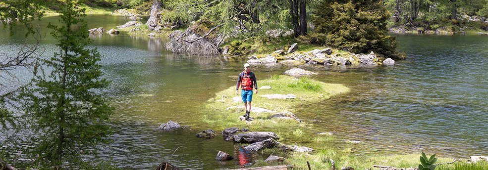
As soon as everyone’s set, we head off in the direction of Wöllaner Nock. It only takes 3 minutes before we turn left onto a narrow path down to the mountain lake, visible in the distance. I have to admit the path is not always the easiest to find, but the red/white/red markings and the odd glance at the navigation map help us to find our way.
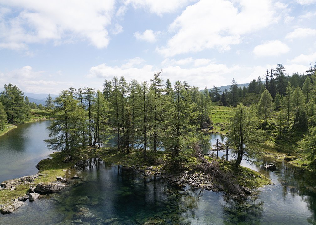
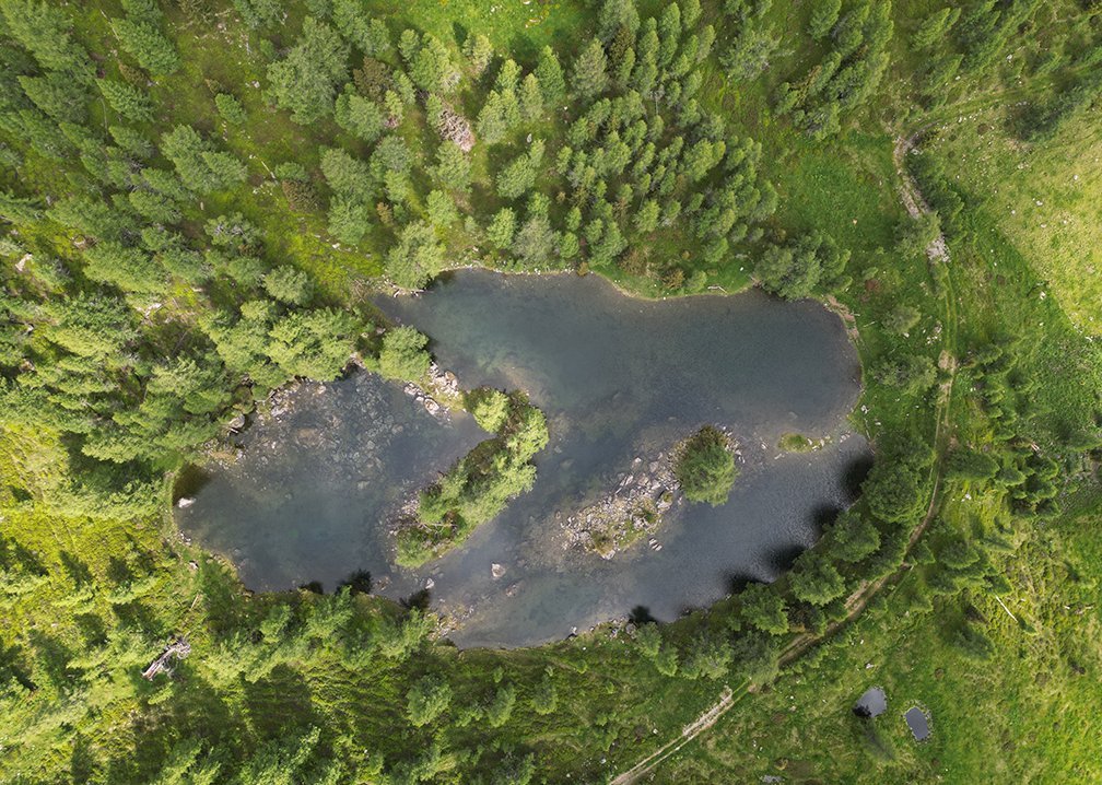
But once we’ve gotten over the somewhat steep descent, our first highlight is waiting for us. A beautiful mountain lake with two islands (most of the time). Why do I say most of the time? Quite simply, the size of the lake depends on its inflows, meaning it varies throughout the year. If you’re feeling brave enough, you should definitely take the plunge into the cold water here – but be careful, the mountain water is really extremely chilly!
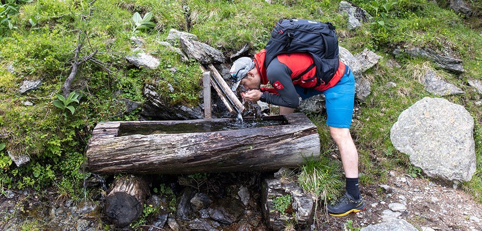
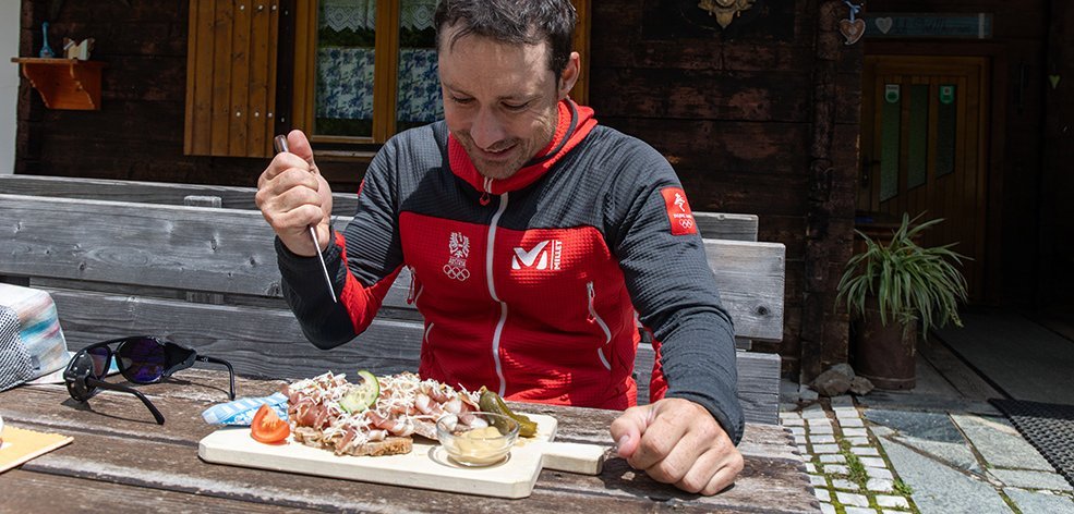
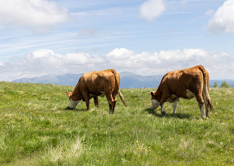
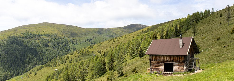
Then we start the climb. Past old alpine huts and various pasture gates, the route always heads south. Initially following a forest path, after about 20 minutes we turn into a huge wild blackberry field, which takes us to the ridge of the Pfaffeneck. Here we hop over a pasture fence and make a detour to the “Stoanerne Mandl” before heading for the Geigerhütte, our hunger spurring us on. It’s located almost 400 vertical metres below us, the charm of this real mountain hut making it the perfect place to try some regional delicacies. With a bit of luck, you may come across a herd of wild horses along the way.
After some refreshments (bacon bread – highly recommended), we set off on the ascent towards Vorderer Wöllaner Nock. It only takes a short stretch of the legs along the hiking trail before we catch sight of the old Arriach drag lift. It’s really hard to imagine that something like this used to be made of wood, but it’s true. From here it gets really steep, but you’ve got the view to the south with the centre of Carinthia, the Karawanken and towards the Gerlitzen Alpe to look forward to.
If the weather conditions are favourable, we’re sure to meet one or two model aeroplane flyers on this south-facing slope. This is one of the best thermal spots for model aeroplane pilots in southern Austria, which is why you can usually experience the most spectacular air show here.
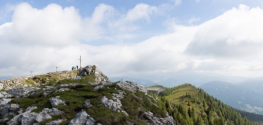
After another 30 minutes, we’ve already reached the summit of the Vorderer Wöllaner Nock (2,090m) and can tick another summit cross off our to-do list.
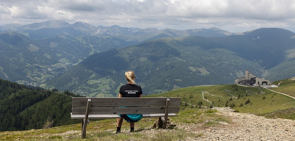
But we haven’t reached the top of today’s tour yet, in a few minutes we reach the “real” Wöllaner Nock (2,145m) – the highest point near the Kaiserburg. There are countless stone cairns here and the best view of the Nockberge mountains by far. The telescope at the summit also provides information about the names of the surrounding mountains and elevations.
It won’t be long now until we get back to the mountain station, enjoy an after-work drink in the summit restaurant and a leisurely ride down to the valley on the Kaiserburgbahn for some well-earned rest. The thermal bath is already waiting for you – and after this tour, you won’t want to skip it!
Have a great start to the summer,
Alex
Instagram: alexanderpayer
Website: www.alex-payer.at


